A Nostalgic Polar Vortex Christmas Scene

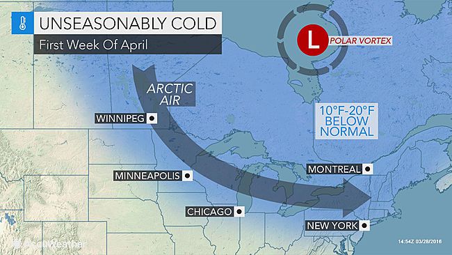
The Chicago Tribune reports, “As subzero cold hits, wind chill advisory for Wednesday night, Thursday morning“.

With overnight temperatures dropping well below zero, the National Weather

Service has issued a wind chill advisory for Wednesday night through Thursday morning.

The advisory is in effect from 9 p.m. Wednesday until 10 a.m. Thursday. The weather service said wind chills could reach minus 30 in some areas. It warned people could suffer frostbite in as little as 30 minutes.

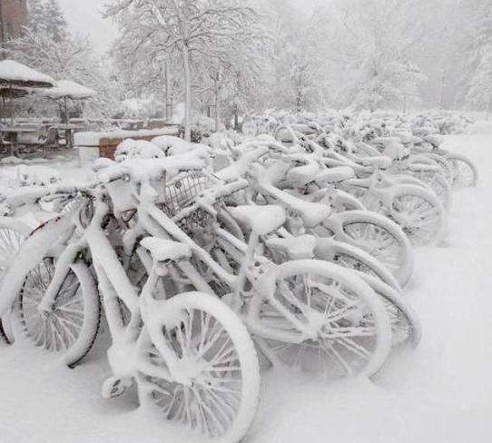
One happy corollary, the sub-freezing temperatures slow Chiraq’s murder rate down a bit. Once the sun comes out, and things warm up again…maybe not so much.

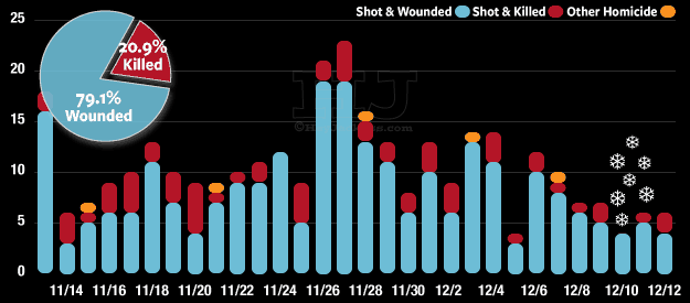
Chiraq Murder stats – HeyJackass.com

AGW – Another Polar Vortex On the Way

From AccuWeather, “Subfreezing highs to return to northeastern US as polar vortex shifts southward“.  It’s just one more example that AGW-Climate Change-Global Warming (AKA: Weather) exists.  Just ask the (AKA: Weather Spokesmodel).

A southward plunge of the polar vortex will bring a quick blast of arctic air directed at the Great Lakes and northeastern United States during the first week of April.

“The latest indications are the core of the coldest air associated with the polar vortex will track a bit farther north AGW_Another_Polar_Vortexand east, compared to the outlook from last week,” according to AccuWeather Long-Range Meteorologist Edward Vallee.

The main thrust of cold air will aim at the Great Lakes, New England and the northern part of the mid-A

There is still a chance the arctic air may sneak farther south at the last minute, according to AccuWeather Long-Range Meteorologist Joe Lundberg.

It is possible for frost and freezing temperatures at night in parts of the central Plains, Tennessee Valley and southern Piedmont areas at the height of the cold air.

The potential for shocking cold and a hard, damaging freeze will exist from the Upper Midwest to the interior Northeast.